Explore the Twin Lakes of North Bali on foot
The Buyan to Tamblingan Trekking Trail is one of the more interesting hiking routes in North Bali for travelers who want to experience Bali’s highland landscape beyond the usual viewpoints.
The trail connects the area around Lake Buyan and Lake Tamblingan, two beautiful highland lakes surrounded by forest, traditional temples, and quiet natural landscapes.
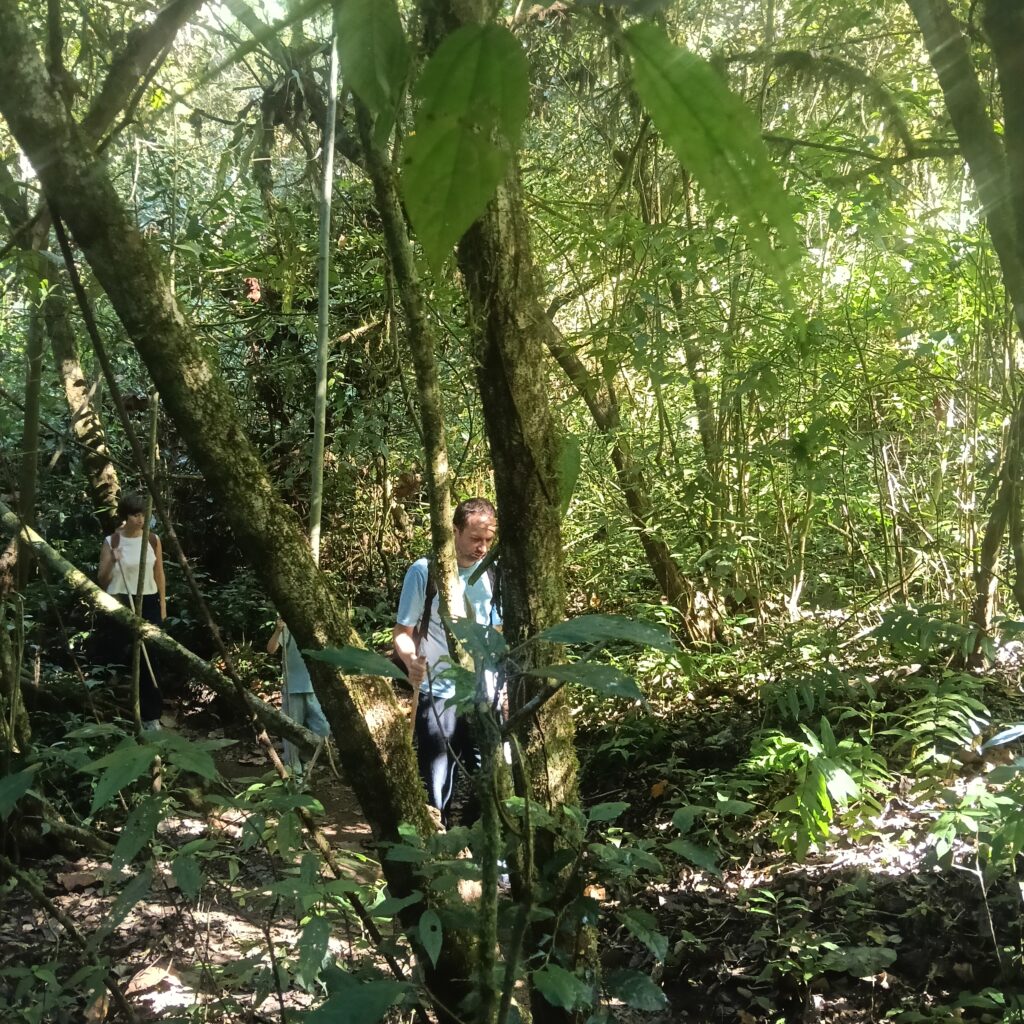
Unlike a short viewpoint stop, this route gives you the opportunity to experience the Twin Lakes area on foot — walking through forest, following lake-side sections, crossing the landscape between the two lakes, and experiencing a quieter side of Bali.
This page is designed as a free self-guided resource to help independent travelers understand the route before starting their hike.
Trail reference: The route information on this page is based partly on the publicly available trail information from AllTrails. Always check current trail conditions before hiking.
Buyan to Tamblingan Trail at a Glance
| Information | Details |
|---|
| Location | North Bali, Indonesia |
| Area | Lake Buyan & Lake Tamblingan |
| Trail type | Hiking / Trekking |
| Difficulty | Moderate |
| Distance | Approximately 14.3 km / 8.9 miles |
| Estimated hiking time | Around 3 hours 46 minutes |
| Entrance fee | Rp 100,000 per person |
| Landscape | Forest, lakes, highlands and rural surroundings |
| Best for | Hiking, nature, photography and exploring North Bali |
| Route reference | AllTrails – Buyan Lake and Tamblingan Lake |
Entrance Fee
The current entrance fee for the Buyan–Tamblingan trekking area is approximately Rp 100,000 per person.
Fees and access arrangements can change, so we recommend confirming the current fee locally before starting your trek.
Where Are Lake Buyan and Lake Tamblingan?
Lake Buyan and Lake Tamblingan are two highland lakes located in the mountainous area of North Bali.
They are often referred to together as the Twin Lakes of Bali because they sit side by side within the same highland landscape.
The area is surrounded by forest and forms part of the natural and cultural landscape of North Bali.
The high elevation gives this part of Bali a noticeably cooler atmosphere than many of the southern tourist areas.
Early mornings can be particularly atmospheric, with mist and clouds moving through the surrounding forest and mountains.
What Makes This Trek Special?
The main attraction of this trail is not a single viewpoint.
It is the combination of several different environments along the journey.
1. Lake Buyan
Lake Buyan is the larger of the two Twin Lakes.
The surrounding landscape includes forest and rural areas, with the mountains creating a dramatic backdrop.
From different points around the lake, you can experience the quiet atmosphere of Bali’s northern highlands.
2. The Forest Between the Lakes
One of the most interesting parts of the route is the transition between the two lakes.
Instead of simply driving from one viewpoint to another, hiking allows you to experience the forested landscape separating the lakes.
The environment can feel surprisingly remote, particularly when there are few other hikers on the trail.
3. Lake Tamblingan
Tamblingan is generally quieter and less developed than many of Bali’s better-known tourist lakes.
The lake sits beneath the slopes of Mount Lesung and is surrounded by forest and traditional temples.
This combination of lake, forest and mountain landscape is what makes Tamblingan particularly interesting for travelers who want a more natural side of Bali.
4. Traditional Temples and Local Culture
The forest around Tamblingan contains a number of Balinese temples and sacred sites.
This is one reason the area feels different from a conventional tourist attraction.
When hiking here, remember that some locations are sacred places used by the local community. Visitors should dress respectfully and follow local rules when entering temple areas.
What You Can Expect on the Trail
The Buyan–Tamblingan area is not a paved tourist walking path.
Trail conditions can change depending on weather and season.
You may encounter:
- Forest paths
- Uneven ground
- Muddy sections after rain
- Slopes and steps
- Lake views
- Dense vegetation
- Traditional temples
- Quiet sections with very few people
For this reason, appropriate footwear and preparation are important.
Use Our Free Google Map
We are creating a free Google Map for the Buyan to Tamblingan Trekking Trail to make this route easier to understand for independent travelers.
The map can be used to identify:
START → Trail Points → Lake Buyan → Forest Section → Lake Tamblingan → FINISH
You can save the map to your phone before starting your hike.
Buyan to Tamblingan Trekking Trail
Our goal is to make useful local hiking information available to travelers who want to explore Bali independently.
You do not have to book a guide to use this resource.
Hiking Independently or With a Local Guide?
This route can be approached as a self-guided adventure if you are comfortable navigating natural trails and have prepared your route in advance.
However, if you prefer to have someone who knows the local trails, forest conditions, cultural sites and the area around the Twin Lakes, a local guide can make the experience easier and more informative.
A local guide can also help you understand the landscape and local culture rather than simply following a line on a map.
Want a Guide or Trekking Package?
If you would prefer to explore Buyan and Tamblingan with a local guide, or if you are looking for a complete trekking package including transportation and other arrangements, you can contact Bali Local Tour Guide.
We can help arrange a local trekking experience around the Twin Lakes based on your preferred route, schedule and group size.
Contact Bali Local Tour Guide to ask about a local guide or Buyan–Tamblingan trekking package.
[
Contact / WhatsApp Bali Local Tour Guide]
Whether you choose to hike independently or with a local guide, our aim is to help you experience this beautiful part of North Bali in a respectful and meaningful way.
When Is the Best Time to Hike?
For a more comfortable experience, an early start is generally a good idea.
Morning conditions can provide:
- Cooler temperatures
- Better hiking conditions
- Softer light for photography
- A quieter atmosphere
- A greater chance of seeing mist around the lakes
However, weather in the Bali highlands can change quickly.
Rain can make forest trails slippery and muddy, so always check the weather and local conditions before starting.
What Should You Bring?
For a hike around the Twin Lakes, we recommend bringing:
- Comfortable hiking shoes
- Drinking water
- Light food or snacks
- Rain jacket
- Small backpack
- Phone with enough battery
- Offline map
- Power bank
- Light jacket
- Cash for entrance fees and local expenses
A rain jacket is particularly useful in this part of Bali because the highland weather can change quickly.
Is This Trek Suitable for Beginners?
The route is classified as moderate, and the total distance is substantial.
It is therefore better suited to travelers who are comfortable with several hours of walking and uneven natural terrain.
You do not need to be an experienced mountain climber, but this should not be treated as a short sightseeing walk.
If you are unsure about the route, hiking with someone familiar with the area can make the experience easier and safer.
Respect the Forest and Sacred Places
The Buyan–Tamblingan area is more than a scenic hiking destination.
It is also an important natural and cultural landscape.
Please:
- Do not leave rubbish
- Do not damage plants
- Stay on established trails where possible
- Do not enter restricted areas
- Respect temples and sacred places
- Follow local instructions
- Keep noise to a minimum
- Do not take anything from the forest
The objective is simple:
Enjoy the landscape without changing it.
AllTrails Reference
The trail used as the reference for this self-guided resource is the Buyan Lake and Tamblingan Lake route published on AllTrails.
AllTrails currently lists the route at approximately 14.3 km (8.9 miles) with a moderate difficulty rating and an estimated hiking time of approximately 3 hours 46 minutes.
We recommend checking the original trail reference together with our local information and Google Map before beginning your hike.
Trail conditions can change, particularly after heavy rain.
Explore More of Bali With Bali Local Tour Guide
This Buyan–Tamblingan trail is part of our effort to create useful free local travel resources across Bali.
Bali has many places that can be explored beyond the standard tourist routes — from mountain trails and jungle paths to waterfalls, villages, lakes and remote natural areas.
Our goal is to help travelers discover these places with better local information.
Some routes can be explored independently.
For other routes, particularly longer mountain treks, remote jungle trails or routes where navigation and local conditions can be challenging, having a local guide can make the experience more comfortable and meaningful.
Explore Bali. Walk beyond the usual places. Discover the island from a local perspective.
Need a Local Guide?
If you would like a local guide or a complete trekking package for the Buyan–Tamblingan route, feel free to contact Bali Local Tour Guide.
We can help you plan the experience according to your preferred date, route, group size and starting point.
[Contact Bali Local Tour Guide →]
Important Trail Note
Online trail maps are references, not guarantees of current access.
Before starting the Buyan–Tamblingan trek, check current weather, trail conditions, access restrictions and local instructions.
If you are hiking during or shortly after heavy rain, consider postponing the trek because forest trails may become slippery, muddy or temporarily difficult to pass.