Mount Catur, also known as Pucak Mangu, is one of Bali’s highland trekking destinations, offering a quieter mountain experience through tropical forest, traditional landscapes, and the sacred area around Pura Pucak Mangu.
This guide focuses on the Mount Catur trekking trail via Pelaga Village, which is one of the main approaches to the mountain.
For independent hikers, this page is intended as a practical trail reference to help you understand the starting area, the character of the route, what to expect in the forest, and how the trek can be continued toward the Bedugul side.
For travelers who prefer a fully organized experience, Bali Local Tour Guide also offers a private trekking package starting from Pelaga and finishing in Bedugul.
Mount Catur Trekking Trail – Quick Overview
| Information |
Details |
| Mountain |
Mount Catur / Pucak Mangu |
| Elevation |
Approximately 2,096 metres above sea level |
| Starting Area |
Pelaga Village |
| Main Trail Experience |
Tropical forest and mountain trekking |
| Cultural Highlight |
Pura Pucak Mangu |
| Route on this Map |
Mount Catur via Pelaga |
| Possible One-Way Route |
Pelaga → Mount Catur → Bedugul |
| Difficulty |
Moderate to challenging depending on route and conditions |
| Environment |
Cool, humid highland forest |
| Best For |
Hikers, nature lovers and travelers looking for a quieter Bali mountain experience |
Mount Catur rises to approximately 2,096 metres, and the Pelaga approach is one of the established ways to reach the higher mountain area and Pura Pucak Mangu.
📍 Mount Catur Trekking Map – Via Pelaga
The Google Map on this page is designed as a reference for travelers who want to understand the Mount Catur trail from the Pelaga side.
Recommended map concept:
Mount Catur Trekking Trail – Via Pelaga Village
The route takes you from the Pelaga highland area into the mountain environment and toward the higher sections of Mount Catur.
If you are planning to trek independently, save the map before leaving because mountain conditions can affect visibility and navigation.
What the map is useful for
The map can help you:
- identify the Pelaga starting area
- understand the general direction of the mountain trail
- follow the route toward the higher sections
- understand the relationship between Pelaga and Mount Catur
- plan transportation before and after the trek
- understand the possibility of continuing toward Bedugul instead of returning to Pelaga
Important: A digital map should be treated as a navigation reference, not as a replacement for local knowledge. Forest trails can change, become overgrown or become difficult to recognize after rain.
Starting Mount Catur Trek from Pelaga Village
Pelaga is located in the highlands of Badung Regency and provides an eastern approach to Mount Catur.
The beginning of the journey feels different from the more developed tourist areas of Bali. The surroundings are dominated by highland agriculture, villages, forest and cooler mountain air.
From the Pelaga side, the trail gradually moves from the village/highland environment into the forest before continuing toward the upper mountain.
The route is particularly attractive for travelers who enjoy the journey through the forest rather than simply walking to a viewpoint.
You can expect a mixture of:
- forest paths
- uneven natural ground
- roots and rocks
- steeper sections
- humid tropical vegetation
- cooler mountain temperatures
- sections of constructed or stepped trail
- changing forest conditions as you gain elevation
After rain, some parts can become muddy or slippery, so appropriate trekking shoes are strongly recommended.
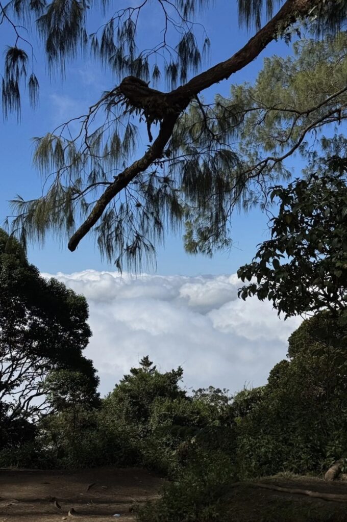
🌿 Trekking Through the Mount Catur Forest
One of the best parts of the Pelaga route is the forest environment.
Instead of immediately entering a highly exposed mountain landscape, much of the journey takes place under the tropical forest canopy.
The atmosphere can be cool and quiet, particularly in the morning.
As you climb higher, the vegetation and terrain gradually change. Some sections become steeper, and the trail requires more concentration.
This is one reason Mount Catur is better approached as a real mountain trek, rather than a casual sightseeing walk.
If the weather is wet, expect slippery surfaces and reduced visibility.
🛕 Pura Pucak Mangu and the Cultural Side of Mount Catur
Mount Catur is not only a natural hiking destination.
Near the higher part of the mountain is Pura Pucak Mangu, an important sacred site connected with Balinese Hindu traditions.
For local people, the mountain has cultural and spiritual significance.
Visitors should therefore treat the temple and surrounding areas respectfully.
When approaching the temple:
- dress appropriately
- respect local religious activities
- follow signs and local instructions
- avoid disturbing ceremonies
- do not enter restricted areas
- keep the area clean
If you trek with a local guide, this part of the journey can become much more meaningful because the guide can explain the cultural background rather than simply showing you the way.
🏔️ Reaching the Higher Area of Mount Catur
As you continue toward the upper mountain, the character of the trail becomes more rugged.
The exact experience depends on weather, trail conditions and the route followed.
From the higher areas, on clear days, the surrounding highlands can provide views toward Bali’s mountain and lake landscape, including the Bedugul area and lakes such as Lake Beratan, Lake Buyan and Lake Tamblingan.
However, visibility can change quickly.
Cloud, mist and rain are common possibilities in Bali’s highland environment, so do not plan the trek based only on the expectation of having a completely clear summit view.
The forest itself is an important part of the experience.
🔄 Return Trek or One-Way Trek?
One of the interesting things about Mount Catur is that you do not necessarily have to return to the same starting point.
There are several ways to experience the mountain.
Option 1 – Pelaga Back-to-Back Trek
Pelaga → Mount Catur/Puncak Mangu → Pelaga
This is the simpler option for independent hikers who need to leave their vehicle at the starting point.
You climb from Pelaga, reach your planned destination on the mountain, and then return using the same general route.
This makes transportation easier because your vehicle remains in Pelaga.
Option 2 – Pelaga to Bedugul
Pelaga → Mount Catur → Puncak Mangu → Bedugul
This is a one-way mountain crossing.
Instead of returning to Pelaga, you continue across the mountain toward the Bedugul side.
This creates a very different trekking experience because you experience the mountain in one continuous journey rather than retracing the same trail.
The disadvantage is transportation logistics.
Your vehicle cannot simply remain in Pelaga because you will finish somewhere else.
This is why a one-way trek is best planned in advance.
The Mount Catur Guide reference also identifies Pelaga → Bedugul as one of the main ways to experience the mountain, while the reverse Bedugul → Pelaga route is another possible crossing.
🚗 Transportation for the Pelaga to Bedugul Trek
This is one of the most important things to understand before choosing the one-way route.
If you start in Pelaga and finish in Bedugul:
Your transportation needs to be arranged at the Bedugul finishing area.
For independent travelers, this can be more complicated than a normal return hike.
You need to consider:
- where your vehicle is parked
- how you will reach the Pelaga starting point
- where you will finish
- who will meet you in Bedugul
- whether your driver can wait at the finishing area
- weather and trail conditions
- the actual time required for your trek
If you are traveling with a private driver, discuss the route and finishing point before starting the hike.
🥾 Is Mount Catur Suitable for Beginners?
Mount Catur is not a simple walking trail.
The route involves elevation gain, forest terrain and sections that can become steep or slippery.
Your experience will depend on:
- fitness level
- weather
- trail condition
- trekking pace
- route direction
- how far you continue toward the summit area
A reasonably fit traveler with hiking experience should be able to enjoy the trek with proper preparation.
However, if you are unfamiliar with Bali’s mountain trails, a local guide can make the experience considerably easier.
🧭 Why Consider a Local Guide?
A local guide is particularly useful if you want to cross from Pelaga to Bedugul.
The guide can help with:
Navigation
Forest trails are not always as straightforward as roads or urban walking routes.
A local guide knows the route and can help identify the correct trail.
Local Knowledge
Instead of simply walking through the forest, you can learn about:
- local plants
- the mountain environment
- village life
- Balinese traditions
- Pura Pucak Mangu
- the cultural importance of the mountain
Route Logistics
For a one-way trek, logistics are just as important as the trekking itself.
A local trekking service can coordinate the starting point, finishing point and transportation so you can concentrate on the hike.
🌄 Full Mount Catur Trekking Package – Pelaga to Bedugul
For travelers who want to experience Mount Catur without worrying about the transportation and trekking logistics, Bali Local Tour Guide offers a private full-package experience.
The route is:
Pelaga Village → Mount Catur / Pucak Mangu → Bedugul
This is particularly suitable if you want to experience Mount Catur as a one-way mountain crossing rather than climbing up and returning to Pelaga.
The current package includes:
- Private hotel transfer
- Private local trekking guide
- Entrance fee
- Mineral water
- Coffee or tea at the summit
- Traditional Balinese cakes
- Trekking from Pelaga toward Mount Catur
- Descent toward Bedugul
The package is designed for a private trekking experience, with approximately 5–6 hours of trekking, depending on conditions and trekking pace.
You can learn more about the full package through the Bali Local Tour Guide – Mount Catur Trekking from Pelaga to Bedugul page.
☕ A Different Kind of Mountain Experience
One of the nice touches of the guided experience is taking time at the summit area rather than immediately rushing back down.
After reaching the higher part of Mount Catur, you can enjoy a simple cup of coffee or tea with traditional Balinese cakes while taking in the mountain environment.
For many travelers, this makes the experience feel less like simply “collecting another Bali summit” and more like spending a day in Bali’s highlands with a local guide.
📋 What to Bring for Mount Catur Trekking
For an independent or guided trek, prepare properly.
Recommended items include:
- Good trekking shoes with grip
- Comfortable trekking clothes
- Light jacket
- Rain jacket
- Drinking water
- Snacks
- Small backpack
- Sun protection
- Personal medication
- Phone with offline map
- Power bank
- Small first-aid supplies
If you start very early or plan a sunrise experience, bring a reliable headlamp or flashlight.
🌦️ Best Time to Trek Mount Catur
The mountain can be trekked throughout the year, but weather has a major effect on the trail.
The dry season generally provides more comfortable trail conditions, while rain can make forest sections muddy and slippery.
Starting early is generally a good idea because highland clouds can build later in the day.
Do not continue a mountain trek if weather conditions become unsafe.
Always check the weather before leaving and be prepared to change your plan if conditions deteriorate.
⚠️ Important Safety Note
Mount Catur is a mountain environment, not an ordinary tourist walking trail.
Trail conditions can change because of:
- rain
- fallen branches
- mud
- slippery surfaces
- vegetation growth
- fog
- reduced visibility
A route that looks straightforward on a map may feel very different on the ground.
If you are trekking independently, download or save your map before entering the forest and make sure you understand your intended route and finishing point.
For the Pelaga → Bedugul crossing, transportation should be arranged before starting because the finishing point is different from the starting point.
🗺️ Mount Catur Trekking Route Summary
Independent Return Trek
Pelaga → Mount Catur / Puncak Mangu → Pelaga
Best for travelers who want simpler transportation and plan to return to their vehicle.
One-Way Mountain Crossing
Pelaga → Mount Catur / Puncak Mangu → Bedugul
Best for travelers who want to experience both sides of the mountain without retracing the entire trail.
Reverse Crossing
Bedugul → Mount Catur / Puncak Mangu → Pelaga
Another way to cross the mountain, particularly convenient for travelers already staying around Bedugul.
Why Trek Mount Catur?
Mount Catur is a good choice if you are looking for something different from Bali’s most heavily visited trekking destinations.
The experience combines:
🌿 Tropical mountain forest
🏔️ A 2,096-metre highland summit
🛕 Balinese spiritual and cultural heritage
🌄 Views toward Bali’s central highlands
🥾 Genuine mountain trekking
🌱 A quieter natural environment
🚶 The possibility of a one-way Pelaga-to-Bedugul trek
The most interesting part may not be the summit itself, but the complete journey through the changing landscape of Bali’s highlands.
Final Tips Before Starting
If you plan to trek Mount Catur via Pelaga, take a few minutes to prepare before leaving.
Save your map. Check the weather. Wear proper trekking shoes. Carry enough water. Know where you are finishing.
And if you are planning the one-way Pelaga → Mount Catur → Bedugul route, make sure your transportation is organized before you start.
For independent hikers, the Google Map on this page is provided as a useful trail reference.
For travelers who prefer to have the route, local guide, transportation and trekking logistics organized as one private experience, you can consider the Bali Local Tour Guide full package from Pelaga to Bedugul.
Enjoy Mount Catur, respect the mountain, and take the time to experience the forest and local culture along the way.