Mount Batukaru is one of Bali’s most fascinating mountain trekking destinations. Rising to approximately 2,276 meters above sea level, Mount Batukaru is the second-highest mountain in Bali and is surrounded by dense tropical rainforest, traditional villages, plantations, sacred temples, and remote mountain landscapes.
Unlike some of Bali’s more commercialized hiking destinations, Mount Batukaru offers a quieter and more natural trekking experience. The mountain can be approached from several different directions, with each route offering a different landscape, difficulty, and cultural character.
This page provides an overview of the main Mount Batukaru trekking trails and their starting areas, helping hikers understand the different ways to explore the mountain.
For travelers looking for a guided sunrise experience, Bali Local Tour Guide currently recommends and operates the Mount Batukaru Sunrise Trekking route via Pura Malen in Pujungan.
Mount Batukaru Trekking Trails
There are several known approaches to the summit of Mount Batukaru.
The main documented routes include:
- Pujungan / Pura Malen Route
- Wongaya Gede / Pura Luhur Batukaru Route
- Jatiluwih Route
- Sarinbuana / Biyahan Route
There are also less-documented alternative approaches associated with areas such as Sanda and Mucak Sari.
Because Mount Batukaru is a sacred and heavily forested mountain, trail conditions, access arrangements, and local regulations can change. Hikers should always check current conditions and local access requirements before starting their trek.
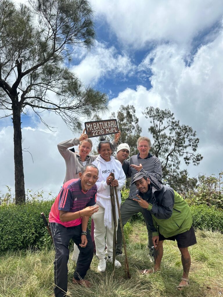
1. Mount Batukaru Trekking via Pura Malen – Pujungan
Recommended Route for Sunrise Trekking
Starting Point: Pura Malen, Pujungan, Pupuan, Tabanan
Direction: North-western side of Mount Batukaru
Approximate distance: 6 km to the summit
Approximate elevation gain: 1,100 m
Typical ascent: 4–6 hours
The Pura Malen route, also known as the Jalur Pujungan Pupuan, is located on the north-western side of Mount Batukaru.
This is the route used by Bali Local Tour Guide for its Mount Batukaru Sunrise Trekking Tour.
The trail begins near Pura Malen and climbs steadily through the mountain forest toward the summit. The route is well defined in many sections but becomes consistently steep, making it a serious mountain trek rather than a casual nature walk.
According to recent trail documentation, the route is approximately 6 km to the summit with around 1,100 meters of elevation gain and normally requires around 4–6 hours for the ascent, depending on fitness, pace, weather, and trail conditions.
Pura Malen itself is an important local temple in Pujungan and has cultural and spiritual connections with the surrounding community. Local information about Pura Malen also confirms that the temple is located along the Mount Batukaru trekking access and that community parking is available near the temple.
Why Choose the Pura Malen Route?
This route is particularly suitable for travelers who want:
- Mount Batukaru sunrise trekking
- A quieter mountain experience
- Dense tropical rainforest
- A challenging uphill trek
- A local guide familiar with the trail
- A less commercialized trekking environment
- A direct route toward the summit from the north-west
For visitors who want to experience Mount Batukaru before sunrise, starting from Pura Malen allows the trek to begin during the early hours of the morning and continue through the forest toward the summit.
Mount Batukaru Sunrise Trekking via Pura Malen
Bali Local Tour Guide offers a private sunrise trekking experience using this route.
The current tour itinerary starts in the early morning, with trekkers beginning the mountain ascent around 2:30 AM and aiming to reach the summit at approximately sunrise. The package includes a private local trekking guide, transportation options, trekking equipment, entrance arrangements, water, and a light breakfast.
Learn more: Mount Batukaru Sunrise Trekking via Pura Malen.
2. Mount Batukaru Trekking via Wongaya Gede / Pura Luhur Batukaru
Starting Point: Pura Luhur Batukaru / Wongaya Gede
Direction: Southern side
Approximate distance: 11.9 km
Approximate elevation gain: 1,460 m
Typical ascent: 6–8 hours
The Wongaya Gede route is one of the traditional approaches to Mount Batukaru.
The trail starts in the area of Pura Luhur Batukaru and climbs northward toward the mountain. This route has traditionally been one of the better-known approaches to the summit and has strong cultural and spiritual associations with Mount Batukaru.
It is substantially longer than the Pura Malen route. Recent trail documentation estimates approximately 11.9 km and around 1,460 meters of elevation gain, with an ascent generally taking 6–8 hours.
For visitors interested in Balinese culture and the sacred landscape surrounding Mount Batukaru, this route offers a very different perspective from the Pujungan approach.
Because the area contains sacred temples and culturally significant locations, visitors should respect local rules, temple etiquette, and any access restrictions.
3. Mount Batukaru Trekking via Jatiluwih
Starting Area: Jatiluwih / Gunung Sari area
Direction: South-east
Approximate distance: 11.6 km
Approximate elevation gain: 1,400 m
Typical ascent: 5–7 hours
The Jatiluwih approach provides another way to experience Mount Batukaru from the south-eastern side.
This route passes through forested terrain and includes a narrow ridge section closer to the upper mountain.
Recent trail documentation describes the route as approximately 11.6 km with around 1,400 meters of elevation gain and a typical ascent of 5–7 hours.
The Jatiluwih route is particularly interesting for hikers who want to combine the mountain environment with the cultural landscape of the Jatiluwih highlands.
The surrounding area is famous for its traditional agricultural landscape, rice terraces, temples, and mountain scenery.
This makes the Jatiluwih approach quite different from the Pura Malen route, even though both ultimately lead toward Mount Batukaru.
4. Mount Batukaru Trekking via Sarinbuana / Biyahan
Starting Area: Sarinbuana / Biyahan
Direction: Southern side
Approximate distance: 15.3 km
Approximate elevation gain: 1,520 m
Typical ascent: 6–8 hours
The Sarinbuana or Biyahan route is another southern approach to Mount Batukaru.
It is a considerably longer route and has been described as a relatively gradual alternative compared with some of the steeper approaches. However, parts of the trail can become overgrown depending on current conditions.
The route eventually converges with the Wongaya Gede / Pura Batukaru route closer to the upper mountain.
Recent documentation estimates approximately 15.3 km and 1,520 meters of elevation gain, with an ascent of around 6–8 hours.
This route is particularly interesting for experienced hikers who prefer a longer forest journey and want to explore a less commonly used approach to Mount Batukaru.
5. Mount Batukaru Alternative Route – Sanda
Starting Area: Sanda Village
Direction: Western / south-western side
Sanda is sometimes associated with alternative approaches toward the Mount Batukaru mountain area.
Compared with Pura Malen, Wongaya Gede, Jatiluwih, and Sarinbuana, this route has considerably less publicly documented information regarding exact trail distance, elevation gain, trekking time, and current access.
For that reason, hikers should not assume that information from another Mount Batukaru route applies to the Sanda approach.
If planning to use this route, local confirmation of the current trail and access conditions is strongly recommended.
6. Mount Batukaru Alternative Route – Mucak Sari
Starting Area: Mucak Sari area
Mucak Sari is another area that has been associated with alternative access toward the Mount Batukaru landscape.
However, publicly available information about this approach is limited compared with the better-documented Pura Malen, Wongaya Gede, Jatiluwih, and Sarinbuana routes.
Because trail conditions and access can change in mountain environments, this route should be considered an alternative local approach rather than a standardized trekking route with fixed public statistics.
For visitors considering this route, arranging a local guide and confirming the current access conditions is recommended.
Comparing the Main Mount Batukaru Routes
| Route |
Starting Area |
Direction |
Approx. Ascent |
Typical Ascent Time |
| Pura Malen / Pujungan |
Pura Malen |
North-west |
1,100 m |
4–6 hours |
| Wongaya Gede / Pura Luhur Batukaru |
Pura Luhur Batukaru |
South |
1,460 m |
6–8 hours |
| Jatiluwih |
Jatiluwih / Gunung Sari |
South-east |
1,400 m |
5–7 hours |
| Sarinbuana / Biyahan |
Sarinbuana / Biyahan |
South |
1,520 m |
6–8 hours |
| Sanda |
Sanda |
West / south-west |
Not consistently documented |
Varies |
| Mucak Sari |
Mucak Sari |
Alternative approach |
Not consistently documented |
Varies |
Distances and trekking times are approximate and can vary considerably according to weather, fitness, trail conditions, route interpretation, and whether a trek is being completed as a sunrise ascent or a normal daytime hike. The four primary routes above are supported by recent trail documentation.
Which Mount Batukaru Route Should You Choose?
There is no single best route for everyone.
The best route depends on the type of mountain experience you are looking for.
Choose Pura Malen if you want:
- Sunrise trekking
- A direct summit approach
- Dense rainforest
- A quieter trekking experience
- A local guide
- A challenging but relatively direct route
Choose Wongaya Gede if you want:
- A traditional approach
- A strong connection with Pura Luhur Batukaru
- A longer mountain trek
- A culturally significant starting area
Choose Jatiluwih if you want:
- Jungle trekking
- Mountain scenery
- A connection with the Jatiluwih highlands
- A longer adventure through the forest
Choose Sarinbuana if you want:
- A longer mountain expedition
- A quieter route
- Extensive forest trekking
- An alternative southern approach
Mount Batukaru Trekking with a Local Guide
Mount Batukaru is not simply a mountain that should be judged by its elevation.
The terrain, rainforest environment, steep sections, changing weather, limited visibility before sunrise, and remote sections of trail make local knowledge particularly valuable.
For sunrise trekking, the importance of navigation increases because much of the ascent takes place in darkness.
A local guide can help with route navigation, pacing, weather awareness, trail conditions, mountain etiquette, and local knowledge of the surrounding landscape.
Bali Local Tour Guide provides local-guided Mount Batukaru trekking experiences for travelers who want to explore the mountain with someone familiar with the surrounding trails and communities.
Mount Batukaru Sunrise Trekking via Pura Malen
For travelers specifically looking for a Mount Batukaru Sunrise Trekking Tour, our recommended route is via Pura Malen, Pujungan.
This is the route used for our private Mount Batukaru Sunrise Trekking experience.
The journey begins during the early morning hours and continues through the rainforest toward the summit. After reaching the top, trekkers can enjoy the sunrise and panoramic views across Bali, weather permitting.
The current private experience is designed for travelers who want to experience Mount Batukaru away from the crowds and explore one of Bali’s more peaceful mountain environments with a local trekking guide.
Mount Batukaru Sunrise Trekking via Pura Malen
Private trekking • Local guide • Sunrise • Rainforest • Summit experience
Important Information Before Trekking Mount Batukaru
Mount Batukaru is a sacred mountain and a serious trekking destination.
Before starting your trek:
- Check current weather conditions.
- Confirm the current trail condition.
- Follow local rules and temple etiquette.
- Use appropriate hiking shoes.
- Bring sufficient water.
- Carry rain protection because mountain weather can change quickly.
- Start with adequate lighting for sunrise trekking.
- Consider using an experienced local guide.
- Do not leave rubbish on the mountain.
- Respect the forest, temples, local communities, and sacred areas.
Trail conditions can change, particularly during Bali’s rainy season. Distances and trekking times should therefore be treated as estimates rather than fixed guarantees.
Discover the Mount Batukaru Trekking Trails
Mount Batukaru offers more than one way to reach the mountain.
From the northern forests of Pujungan and Pura Malen to the sacred surroundings of Wongaya Gede, the highlands of Jatiluwih, and the forest routes around Sarinbuana, each approach provides a different perspective of Bali’s second-highest mountain.
For travelers looking for a sunrise trekking experience, Bali Local Tour Guide recommends the Pura Malen route as the route used for our Mount Batukaru Sunrise Trekking Tour.
Explore Mount Batukaru with a local guide and discover one of Bali’s most peaceful and challenging mountain environments.